

Preview
Identifier
8x10_006_1986_44_4340
Approximate Date
November 1947
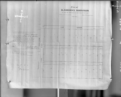
Description
This black and white photograph features a blueprint and description of the Plat of Glasscock's subdivision of part of the N. E. 1/4 of Section 4 T. 24 R. 13 dated September 1885. Ray Fox ordered the photograph.
Physical Description
8" x 10" Glass-plate negative
Subject
Maps, Plats, Stafford County (Kan.)
Rights
© Stafford County Historical and Genealogical Society. All rights reserved. May not be reproduced without permission. Please credit Stafford County Historical and Genealogical Society as your source.
Publisher
Access provided by FHSU Digital Collections
Collection
Gray Studio Glass Plate Negative Collection
Recommended Citation
Gray, William R., "Box 6, Neg. No. 83264: Photograph of Blueprints - Glasscock's Subdivision" (1947). Stafford County Museum Collection. 6684.
https://scholars.fhsu.edu/stafford_county/6684
Language
eng
Keywords
Maps, Plats, Stafford County (Kan.)

Comments
For questions contact the Stafford County Historical and Genealogical Society.